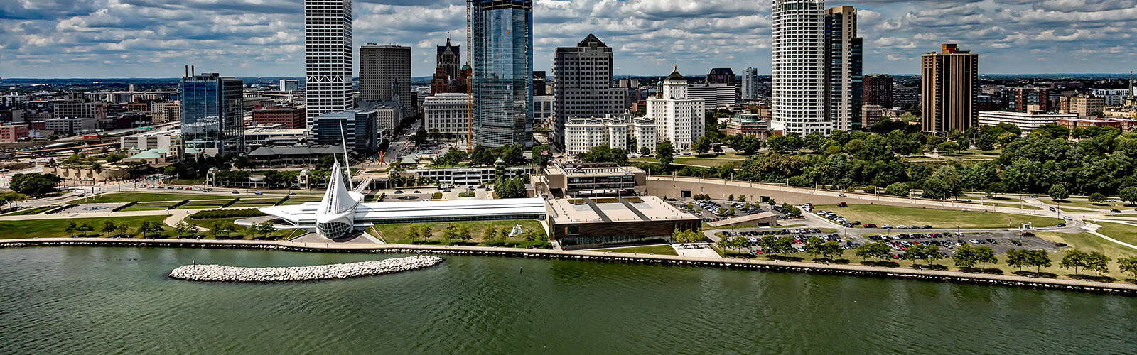
WICCI’s Coastal Resilience Working Group uses innovative methods and technologies to describe and predict the effects that the changing climate will have on the communities and property owners of Wisconsin’s coastlines.
It is challenging to fully appreciate the potential consequences of changing lake levels, precipitation patterns, and storm events that may result from a changing climate. In part, this is because regional climate and lake level projections do not directly translate into specific consequences at the coast like erosion and flooding.
In some cases, the consequences of climate change on coastal communities may not be obvious because projected changes may have conflicting impacts on coastal processes. These projections are also provided via technical data that are often not easily actionable for city planners, resource managers, and residents.
Coastal communities need interpretive tools that synthesize distributed data and translate the predictions of regional climate change models and lake level forecasts into user-friendly, local terms that anyone can understand. Such tools will help decision-makers see the connections between climate modeling and the day-to-day decisions they must make.
Summary of Issues and Impacts
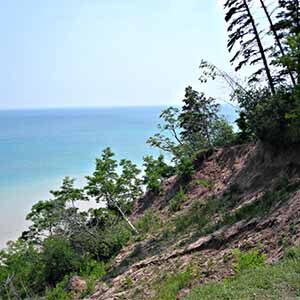
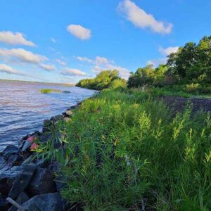
Wisconsin’s Great Lakes coast is composed of bluffs, dunes, beaches, and waterfront infrastructure. These interconnected coastal features serve as the interface between high-value upland areas and the economic, recreational, and cultural assets of the Great Lakes. Processes like fluctuating lake water levels, waves, erosion, sediment transport, and slope failure can combine to damage coastal properties and impair the function of waterfront facilities. Climate change threatens to exacerbate the coastal hazards facing Wisconsin’s coastal communities.
Climate Issues Affecting Coastal Resilience
Fluctuating Lake Levels
Both high and low water level extremes are anticipated to continue under a changing climate. This could include potentially higher highs and lower lows than seen in the historical record. This is because both precipitation and evaporation are anticipated to increase under a changing climate, leading to a tug-of-war in water supply into and out of the lakes that may have more extremes than in the past.
Explore
Declining Ice Cover
The observed trend of declines in the extent and duration of ice cover on the Great Lakes is expected to continue in a future warmer climate. Reduced ice cover exposes the coast to greater wave energy.
Explore
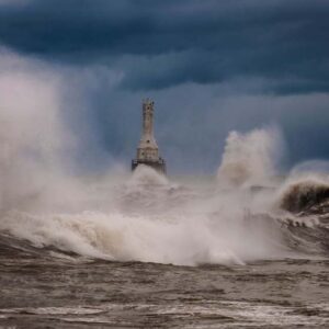
Increasing Wave Energy
Wave energy reaching Great Lakes coasts is expected to increase in the future in part due to anticipated decreases in ice cover extent and duration. A reduction of ice cover will expose the coast to waves for a greater portion of the winter, the season when coastal storm intensity is greatest and large wave events are most frequent. Great Lakes wave energy has also been observed to increase during the summer months, associated with an increased frequency of extreme wind speed events.
Explore
Increasing Precipitation
Trends of increasing precipitation totals and heavy rainfall event frequency are expected to continue under a changing climate. Increased precipitation is likely to decrease bluff slope stability and increase the likelihood of bluff slope collapse.
Explore
- Historic and projected changes in precipitation with the Wisconsin Rainfall Project
Impacts to Coastal Communities
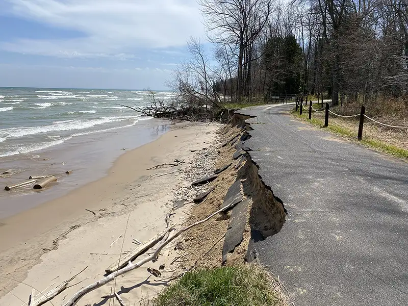
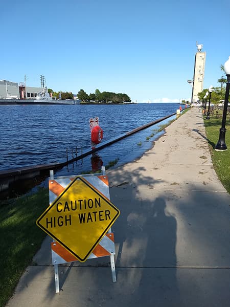
Increased Coastal Flooding, Coastal Erosion, and Infrastructure Damage
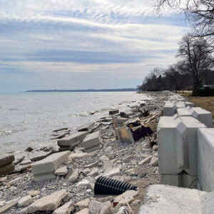
Increased wave energy combined with periodic high Great Lakes water levels is likely to increase coastal flooding, coastal erosion, bluff failure and infrastructure damage. Higher lake levels and waves may also increase flooding of rivers and stormwater infrastructure that drains to the Great Lakes due to higher water levels at outlets into the lake.
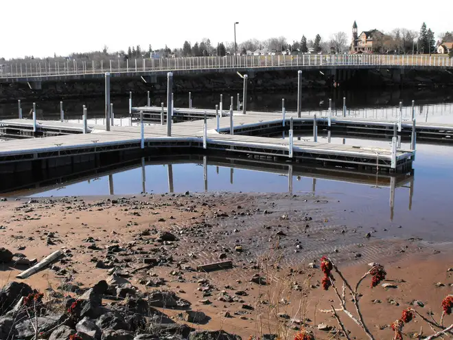
Low water levels will also lead to increased wave downcutting of the lakebed, wave scour at the toe of shore protection structures, and accelerated deterioration of normally submerged timber infrastructure as it becomes exposed to air. Extremely low water level may also lead to insufficient water depths for drinking water intakes to function.
Explore
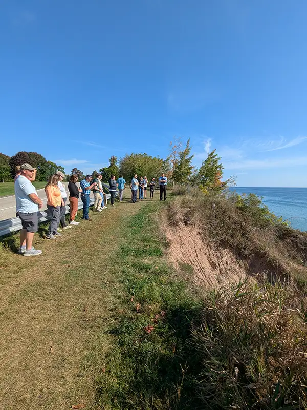
Reduced Bluff Slope Stability
Increased precipitation is likely to lead to a greater number of unstable coastal bluff slopes and subsequent bluff collapses. Greater precipitation and more frequent intense events will increase surface water runoff down the bluff face while additional water infiltrating into the groundwater table will lubricate soil particles and reduce the slope’s stability. This instability will be further compounded by increased erosion from high lake levels and increased wave energy.
Explore
Impairment to Nautical Navigation
Periods of extreme low lake levels, potentially lower than seen in the historic record, will result in insufficient water depths for navigation in ports, harbors, and marinas. Economic loss can result if vessels are not able to access facilities or need to reduce cargo loads to maintain higher drafts. Safety and accessibility issues may occur if large elevation differences exist between dockage and vessels at both extreme high and low lake levels.
Explore
The Coastal Resilience Working Group studied these and other issues in a detailed report. Read the Coastal Resilience Working Group report (pdf).
Recommended Solutions/Strategies
There is no one-size-fits-all solution to the impacts of climate change on coastal communities because Great Lakes coastal conditions and needs vary from community to community and even site to site. A range of possible strategies to address the issues and impacts of climate change on coastal communities are given in this WICCI Coastal Resilience Issues/Impacts/Strategies Table (pdf). The following guiding principles can help coastal communities as they consider how to adapt to the threat of coastal hazards.
Consider Future as Well as Current Conditions
Protect the function of coastal assets by taking actions that consider the full range of possible conditions, including both higher and lower lake levels.
- Resource: Use Strategies for Adapting Great Lakes Coastal Ecosystems to Climate Change (pdf) and the associated Great Lakes Coastal Ecosystems Adaptation Menu (pdf) to identify suitable actions for your site.
- Example: Learn how the Apostle Islands National Lakeshore used these tools to plan for the long-term resilience of coastal wetlands.
Address Root Causes
Identify the root causes of hazard issues and choose management actions that specifically address them. Common solutions may not be the most appropriate for every situation.
- Resource: A Property Owner’s Guide to Protecting Your Bluff can help users notice the signs of bluff instability, identify the root causes, and select best practices to manage them.
- Example: View the Virmond Park Public Access & Water Management StoryMap to see how Ozaukee County improved surface water drainage and groundwater management to reduce bluff instability.
Relocate When Possible
Build or relocate homes, infrastructure, and other assets as far from eroding shorelines and floodways as is feasible. It is often easier and cheaper to avoid the impacts of coastal hazards than it is to fight the forces of the Great Lakes.
- Resource: Learn about the benefits of structure moving, the structure moving process, and how to find and work with a mover from the Building Moving to Save Homes
- Example: Learn the costs of bluff failure in Wisconsin Shores: Coastal Erosion in the Great Lakes, then listen to a homeowner’s experience moving their home to avoid the same costly outcome.
Be Proactive
Plan and implement strategies before coastal hazards have urgent impacts.
- Resource: Consider conducting a coastal vulnerability assessment to identify priority needs, using the Coastal Resilience Self-Assessment (pdf) as a first step.
- Example: Learn how Milwaukee County used the self-assessment tool as a starting point to develop projects that will enhance their capacity to plan, prepare for, and adapt to coastal hazards.
Consider Nature-Based Solutions
Incorporate nature-based solutions or living shorelines into hazard mitigation planning, when possible, to protect coastal investments.
- Resource: Use Nature-Based Shoreline Options for the Great Lakes Coasts to evaluate and compare nature-based solutions and techniques for your project.
- Example: Read how the City of Superior implemented a living shoreline to combat lake level change, runoff, and erosion at Wisconsin Point.
Consider Adjacent Properties
Weigh the impacts that modifications to the coast may have on coastal processes like sediment transport and wave dynamics
- Resource: Explore the Groin Field Impacts at Sheridan Park StoryMap to learn how coastal modifications may increase erosion and accretion at adjacent properties.
- Example: Read how the City of Oak Creek is coordinating shore protection efforts with adjacent landowners to mitigate the threat of erosion across all properties.
Engage the Community
Coordinate actions with neighbors and within communities while balancing the risks to different stakeholder groups.
- Resource: Find others working on coastal resilience issues through communities of practice like the East River Collaborative, Coastal Hazards for Superior (CHAOS), and Collaborative Action for Lake Michigan Coastal Resilience (CALM).
- Example: Watch this video to learn how the East River Collaborative takes a watershed-based approach to flood resilience and places community at the center of its work.
Adjust Management Strategies
Adjust management decisions based on regular monitoring and assessments of current and alternative strategies.
- Resource: Reference the Great Lakes Beach Resilience Guide for information on how to evaluate and adjust strategies.
- Example: See chapter four of the guide and the Samuel Myers Park Restoration StoryMap to learn how the City of Racine iteratively changed their engineering design and management plan to handle higher water levels and larger storm events.
Maintain Coastal Protection Structures
Conduct periodic inspections and maintenance of coastal protection structures to ensure their function and ability to adapt to changing conditions.
- Resource: Check out Best Practice Inspection Guidelines for Great Lakes Port, Harbor and Marina Structures for an introduction to above-water and underwater inspection of coastal structures.
- Example: Read how Port Milwaukee established a Capital Asset Renewal Plan to address deficiencies in port facilities and establish a maintenance and replacement schedule for the Port’s infrastructure.
Environmental and Climate Justice Issues
Access to the Great Lakes for recreation, fishing, and cultural experiences is often influenced by socio-economic factors. This can be due to proximity to Great Lakes access points, resources needed for access (like watercraft), or water quality concerns at convenient access points. Consider incorporating public access to better allow all people to enjoy the Great Lakes as part of resilient approaches to coastal management.
Several low-lying coastal areas vulnerable to flooding in Wisconsin are home to socially vulnerable populations. Environmental justice should be considered when addressing coastal flooding and residents and community groups should be engaged to move towards equitable solutions to flooding.
Stories
The increasing frequency and severity of weather events has made the need for resilience planning urgent for many East River communities in northeast Wisconsin. In 2020, the East River Collaborative was formed to address flooding through a holistic, watershed-based approach to resilience planning and water resource management. This video describes how flooding has impacted the region, the formation of the East River Collaborative, the seven goals of the community-driven East River Flood Resiliency Framework, how community engagement is the center of this work, and the importance of nature-based solutions in improving flood resilience and water quality.
Resources
This is an accordion element with a series of buttons that open and close related content panels.
Understanding Great Lakes Coastal Hazard Issues
Living on the Coast
Booklet describing natural coastal processes and overall strategies to manage risk to coastal properties.
Wisconsin Sea Grant Coastal Processes Manual
Manual that provides step-by-step instructions on how to estimate risk to Great Lakes coastal property from extreme lake levels, storms and erosion.
Great Lakes Quests
Interactive virtual learning activities about coastal resilience issues affecting the Lake Michigan coast of southeastern Wisconsin.
Adapting to a Changing Coast Presentation
Presentation by Adam Bechle, Wisconsin Sea Grant for Wednesday Nite @ the Lab, June 30, 2021. Presentation discuss the water levels the Great Lakes, their impacts, and the actions communities are taking to adapt to a changing coast.
Adaptation Options
Adapting to a Changing Coast – Options and Resources for Lake Michigan Property Owners
Publication with an overview of 16 management options for adapting to changing bluffs and beaches.
Adapting to a Changing Coast – Options and Resources for Local Officials in Southeastern Wisconsin Coastal Communities
Publication with 28 policy, permitting, funding, and collaboration options that local governments can pursue to improve their ability to adapt to changing water levels and other coastal hazards.
A Property Owner’s Guide to Protecting Your Bluff
A guide to help Great Lakes coastal bluff property owners maintain and enhance the stability of their bluffs. Includes a listing of vegetation species suitable for coastal bluffs in Southeastern Wisconsin.
Nature-Based Shoreline Options for the Great Lakes Coasts
A guide describing different types of nature-based shoreline techniques suitable for the Great Lakes featuring case study examples.
Great Lakes Shore Protection Structures and Their Effects on Coastal Processes
Detailed fact sheet describing different types of shore protection structures and their potential impacts, both positive and negative, on the shoreline.
Stabilizing Coastal Slopes on the Great Lakes
Detailed fact sheet describing the coastal conditions and processes that can lead to bluff failure and some options for stabilizing the slope of a coastal bluff.
Wisconsin Shoreline Erosion Control Structures Permitting
Wisconsin Department of Natural Resources website with information on requirements and considerations for shore protection projects in Wisconsin.
NOAA Digital Coast Topic: Natural Infrastructure
Directory of National Oceanic and Atmospheric Administration (NOAA) guidance, data, tools, trainings, and webinars on natural and nature-based solutions for minimizing coastal flooding, erosion and runoff. A specific resource of interest is the Quick Reference on Nature Base Solutions.
Cold Regions Living Shorelines Community of Practice (CRLS CoP)
This climate change adaptation community of practice focuses on effective uses of living shoreline ideas and principles in a temperate North American climate. (registration required)
Maps and Data
Wisconsin Coastal Atlas
A technology platform that provides access to maps, data, catalogs, tools, and information to support decision-making about Wisconsin’s Great Lakes coast.
GeoData@Wisconsin
An online portal to discover and access Wisconsin geospatial data, with specially curated Great Lakes coastal data layers.
Wisconsin Shoreline Inventory and Oblique Viewer
A web mapping tool to view historic photos of the coast, assessments of bluff and shoreline conditions, and measurements of historic bluff and shoreline recession in a web-based, interactive map of Wisconsin coastal data.
NOAA Lake Level Viewer
A web mapping tool to examine the potential impacts of lake level changes on shoreline position and water depth in the Great Lakes.
Great Lakes Water Level Dashboard
A dashboard interface to access and visualize more than 150 years of Great Lakes water level data, as well as seasonal forecasts and climate change projections of future lake levels.
U.S. Army Corps of Engineers Great Lakes Water Level Data
Webpage with near-term water level forecasts and outlooks, as well as current and historic water level data, water supply data, and more.
NOAA GLERL Great Lakes Ice Cover Data
Webpage with current, historical, and forecasted ice cover data for the Great Lakes.
U.S. Army Corps of Engineers Wave Information Study Data
An online portal to long-term wave climatologies for U.S. coastal waters, including the Great Lakes.
Planning and Policy Options
Coastal Resilience Self-Assessment Tool (pdf)
A tool to help communities weigh the effects of common coastal hazards and begin to consider planning and mitigation opportunities that may increase the coastal resilience of their community.
Wisconsin Coastal Communities Overview
Interactive map provides information about the counties, cities, villages and towns that border Lake Michigan and Lake Superior with links to their government website, interactive map, plans and ordinances.
Managing Coastal Hazard Risks on Wisconsin’s Dynamic Great Lakes Shoreline (pdf)
A report that describes coastal hazards in Wisconsin that includes an erosion hazard model ordinance.
Protecting Coastal Investments: Examples of Regulations for Wisconsin’s Coastal Communities
A guide that describes the causes of coastal erosion and provides ordinance language on coastal setbacks, relocatable structures, shoreline protection, stormwater management, site planning, and hazard disclosure.
Great Lake Coastal Resilience Planning Guide
A website with guidance on Great Lakes coastal hazard resilience featuring case studies, tools, maps, data and publications.
Wisconsin Coastal Resilience Hubs and Networks
Coastal Actions for Resilience and Economic Security (CARES) of Southeastern Wisconsin
CARES works with coastal communities in Kenosha, Racine, Milwaukee and Ozaukee counties to identify vulnerabilities, prioritize resilience opportunities and fund local projects to implement top priorities.
Coastal Hazards of Superior (CHAOS)
CHAOS aims to help build strong collaborations between western Lake Superior communities impacted by coastal hazards in both Wisconsin and Minnesota.
East River Collaborative
The East River Collaborative is a community-driven approach to flood resilience planning in the East River Watershed, which is primarily in Brown County, Wisconsin.
Northeastern Wisconsin Coastal Resilience Study
The Northeastern Wisconsin Coastal Resiliency Study worked with coastal communities in Sheboygan, Manitowoc and Kewaunee Counties to examine their coastal hazard issues and identify opportunities to build resilience strategies into local planning efforts.
Wisconsin Coastal Management Data Infrastructure (WICDI)
WICDI is providing data, tools, and training to Wisconsin’s Lake Superior coastal communities to help tackle a key issue in the region: culvert damage during extreme rain events.
Great Lakes-Wide Climate Change Assessments
An Assessment of the Impacts of Climate Change on the Great Lakes
This Environmental Law and Policy Center report released in 2019. Sections of this report that are particularly relevant to coastal resilience include Section 3.2 Great Lakes ice cover trends, Section 3.4 Changes in lake level, Section 5.7 Coastal Processes, and Chapter 6 Public and economic impacts of changes to the Great Lakes.
Fourth National Climate Assessment, Volume II, Chapter 21: Midwest
The U.S. Global Change Assessment Program’s latest National Climate Assessment was released in 2018. Chapter 21 of Volume II has a synthesis of climate change in the Great Lakes in Box 21.1 on page 893.
Working Group Documents
We offer a variety of adaptation sheets and guides, including resources for property owners and local officials.
Adaptation Fact Sheets
- Failing Coastal Wood Infrastructure on the Great Lakes (pdf)
- Resources for Coastal Property Owners (pdf)
- Great Lakes Marina Climate Change Implications (pdf)
- Adapting to a Changing Coast for Local Officials (pdf)
- Adapting to a Changing Coast for Property Owners (pdf)
- Coastal Resilience Climate Change Issues Impacts Strategies (pdf)
Our Team
Stakeholders and Partners
- University of Wisconsin Sea Grant Institute
- Wisconsin Coastal Management Program
- Wisconsin Department of Natural Resources
- Wisconsin Emergency Management
- Municipalities, counties and regional planning commission with jurisdiction along the Lake Michigan and Lake Superior coasts
Members
- Adam Bechle (co-chair), Coastal Engineering Outreach Specialist, University of Wisconsin Sea Grant Institute, bechle@aqua.wisc.edu
- David A. Hart (co-chair), Assistant Director for Extension, University of Wisconsin Sea Grant Institute, dhart@aqua.wisc.edu
- Lydia Salus, Coastal Habitat and Resilience Coordinator, Wisconsin Coastal Management Program
- Jake Kolanowski, Coastal Resilience Coordinator, Wisconsin Coastal Management Program
- Members of the Wisconsin Coastal Management Program’s Coastal Hazards Work Group