Greg Fries is the assistant city engineer for the City of Madison, Wisconsin.
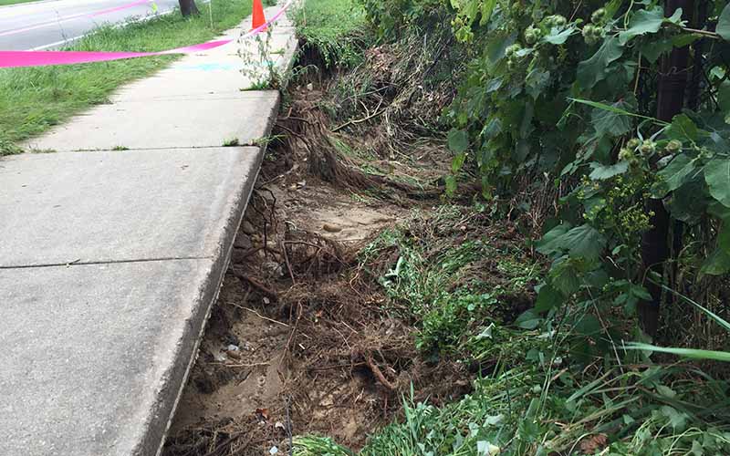
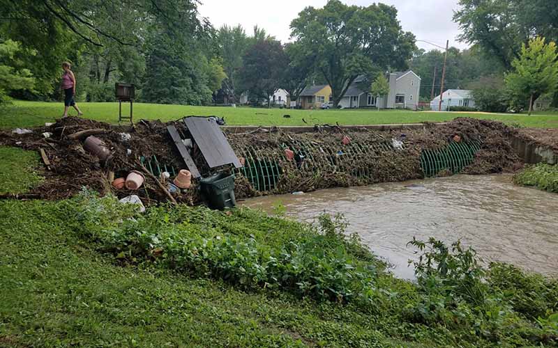
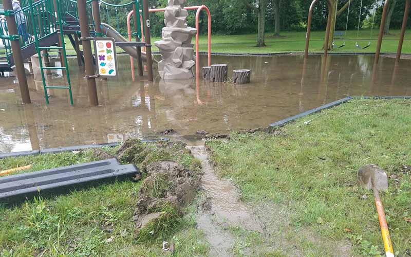
According to the National Weather Service, 11.63 inches of rain fell over 24 hours in August of 2018 in the area west of Madison. The series of storm systems led to widespread flooding and severe weather across southern Wisconsin. Flash floods took place throughout the City of Madison, major intersections were impassible, and homes were flooded. It cost millions of dollars of damage.
What has been happening in Madison in terms of flooding?
When the city began to be developed 150 years ago, much of the downtown and east side were wetlands. When the city was built, they were not pulling out their slide rule to design the pipes needed to move the stormwater. As a result, many of the early development area storm systems have been “buttressed” with additional capacity over the years. This became pretty evident, when I started with the city and started to understand the storm system maps of the city as part of the work on our Wisconsin Pollutant Discharge Elimination System (WPDES) discharge permit.
Even back 30 years ago I understood we had capacity problems in our sewer system, especially downtown and the near east side. Much of those areas are built on made land, or filled in wetlands, and capacity is in many ways subject to the water level of Lake Monona.
When you review historic United States Geological Survey (USGS) Quad maps, the area surrounding Oscar Meyer, the Isthmus area, Park Street, the area around Monona Bay and many areas along Starkweather Creek, were all wetlands. Looking at those areas now, they are virtually completely built out. The city continued to both allow, and actively fill, wetlands to make parks into the 1950s. Environmental concerns aside, the hydraulic problem is that the fill was not placed to a high enough elevation.
In Madison, almost all of the discharge pipes in the areas I described are half or fully submerged at their discharge point at least half the year. In many places there is only two feet of vertical grade from the discharge point to the low point. When the lake is high that difference gets even smaller.
The floods in 2018 revealed how significantly undersized our pipes were because they had never been tested for a big event by today’s standards. Our pipes are always set to drain to low points in a public space, a pond or a greenway, and that worked. The 500-year event was really not considered. In fact, the base statistical design data used until 2014 did not include numbers above the 100-year event. Even now, no matter what I design, there is always an event that will out design me. If we did design for the 1000-year event, very few people could afford to live in the city.
What measures have you taken to address the flooding?
After the 2018 event, it was clear to our entire engineering team that we needed to evaluate our stormwater system in a systematic manner. This became especially clear when looking at updated and alternative intensity duration frequency rainfall data that has become available in the last few years from Professor Dan Wright on the University of Wisconsin campus. When you review that data and recent events, it is clear that the current federal government statistics in Atlas 14 are under-predicting current rainfall patterns.
In the Madison area two things are happening. We are getting more rain in terms of pure volume. Average rainfall in Madison has gone from 32 to close to 40 inches per year. We’ve gained about 8 inches a year. That poses a problem for people who live on the Isthmus and depend on low lake levels to drain areas that were built upon filled wetlands.
One problem is that the lakes respond to rain by rising rather quickly and move very slowly to empty. Even as we work to improve the lake problem and make it possible to empty the system more quickly, through the ongoing Dane County dredging program on the Yahara River, without changes to development patterns in the northern watershed of the lakes, the improvements afforded by dredging will eventually be reduced as runoff volumes continue to increase. Without a change in patterns twenty-five to thirty years from now we will be looking for more solutions to the lake volume issue.
The second problem is extreme events that exceed the capacity of modern systems, including culverts under roads, pipes, and pond systems. That doesn’t bode well for anybody, from agricultural producers to urban stormwater systems. That’s why we are doing watershed studies to try to identify where to spend our money to get our best bang for the buck.
Engineers are applied people. We apply what really smart people figure out. Give us better tools to design with. That will give engineers an opportunity to do it right.
The views and opinions expressed in this interview are those of the authors and do not represent official policy or position of the University of Wisconsin-Madison or the Wisconsin Initiative on Climate Change Impacts.
For More Information
Greg Fries, P.E.
Assistant City Engineer
City of Madison
(608) 260-4090